Waterfalls, lookouts and national parks in Brisbane
Brisbane's wild side begins at the edge of the suburbs. A short drive from the centre, Mt Coot-tha rises over the city with a lookout that gives a wide view of the river and the skyline. Below it, J.C. Slaughter Falls and Gap Creek Reserve offer shady bush walks, and the falls themselves flow best after rain, so treat them as a bonus rather than a promise. There is plenty else close by. Kangaroo Point Cliffs Park gives city views and a place to watch rock climbers. The South Bank Rainforest Walk is a gentle introduction to subtropical green in the middle of the city. Karawatha Forest, Daisy Hill Conservation Park, Bunyaville Conservation Park and Toohey Forest Park are bushland reserves with tracks of different lengths, and some have discovery or visitor centres. Further out, Minjerribah's Point Lookout Gorge Walk follows a headland where dolphins, turtles and, in the cooler months, migrating whales may be seen. It is a drive, a ferry and a walk, so it suits a whole day. Be realistic with children. A short walk to a lookout or creek often delights a four-year-old more than a long track. Take water, because the humidity is hard on small bodies, and watch for snakes and spiders by keeping to the track. Summer storms can make tracks slippery and lightning dangerous, so keep to the cooler months for longer walks.
Our picks
-
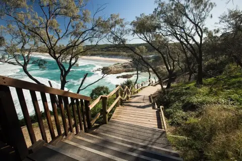 Point Lookout Gorge Walk (Minjerribah / North Stradbroke Island) Point Lookout
The Gorge Walk at Point Lookout on Minjerribah (North Stradbroke Island) is a 1.2 kilometre boardwalk circuit around the headland on Redland City Council land.
★ 4.9 (1,953)
-
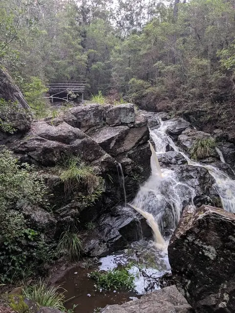 J.C. Slaughter Falls Picnic Area Mount Coot-tha
J.C. Slaughter Falls Picnic Area is one of nine picnic areas in Brisbane City Council's Mt Coot-tha Reserve, off Sir Samuel Griffith Drive.
★ 4.4 (976)
-
 Mt Coot-tha Lookout Mount Coot-tha
Mt Coot-tha Lookout is Brisbane's highest point, a heritage-listed lookout in Mt Coot-tha Reserve with views across the city and out to Moreton Bay.
★ 4.7 (15,237)
-
 Summit Track, Mt Coot-tha Reserve Mount Coot-tha
Brisbane City Council describes the Summit Track (58) as Mt Coot-tha's most popular hike and a relatively easy walk suited to all fitness levels.
1.9 km · relatively easy, suits all fitness levels (Brisbane City Council) · 30 minutes each way · ★ 4.7 (659)
-
 Piccabeen walk, The Gantry (D'Aguilar National Park) Mount Mee
A 1 km circuit trail and boardwalk through eucalypt forest and subtropical rainforest with piccabeen palm groves and tall Sydney blue gums, in the Mount Mee section of…
1 km · Grade 2 walking track · Allow 30min walking time · ★ 4.5 (656)
-
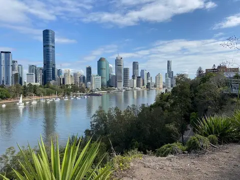 Kangaroo Point Cliffs Park (River Terrace Park) Kangaroo Point
Kangaroo Point Cliffs Park, also called River Terrace Park, is a Brisbane City Council park on upper and lower levels beside the Brisbane River, with entrances at 461…
★ 4.7 (7,054)
Before you go
Best for which ages
Short walks and lookouts, such as Mt Coot-tha and the South Bank walk, suit toddlers and preschoolers. Primary children enjoy tracks with a creek or falls. Teenagers might prefer longer bush tracks in the forest reserves, where they can walk ahead and explore.
What to bring
Carry more water than seems sensible in the humidity, plus a hat, sunscreen and sturdy closed shoes for the roots and rocks. Pack insect repellent, since mosquitoes and ticks can be a nuisance in bush reserves. A light rain jacket helps with sudden showers, and a first-aid kit and charged phone are sensible.
Parking and facilities
Mt Coot-tha lookout gets busy at sunset and on weekends. Smaller reserves usually have basic parking and few facilities. The listing says what is on site, including toilets, and it helps to use them before setting out. Arrive before the sun-seekers do and you will find a space and a quiet track.
Best time of year
Winter and early spring are the most comfortable for longer walks, with dry air and clear views. Summer is hot, humid and stormy, so go early and finish before the afternoon. Falls and creeks are best after good rain. Bush reserves are at their greenest after the summer rain, though the tracks can be muddy and the mozzies out.
Prams and accessibility
Some lookouts and the South Bank walk are paved and suit prams. Many bush tracks have steps, roots and gravel and are not suitable for wheelchairs. Check the listing for surface details, and use a baby carrier on rougher ground.
Waterfalls, lookouts and forest walks
Walks the park service or council describes with a length and grade. Each listing says how far, how hard, and what is at the start.
-
Point Lookout Gorge Walk (Minjerribah / North Stradbroke Island) Point Lookout
The Gorge Walk at Point Lookout on Minjerribah (North Stradbroke Island) is a 1.2 kilometre boardwalk circuit around the headland on Redland City Council land.
★ 4.9 (1,953)
-
J.C. Slaughter Falls Picnic Area Mount Coot-tha
J.C. Slaughter Falls Picnic Area is one of nine picnic areas in Brisbane City Council's Mt Coot-tha Reserve, off Sir Samuel Griffith Drive.
★ 4.4 (976)
-
Mt Coot-tha Lookout Mount Coot-tha
Mt Coot-tha Lookout is Brisbane's highest point, a heritage-listed lookout in Mt Coot-tha Reserve with views across the city and out to Moreton Bay.
★ 4.7 (15,237)
-
Summit Track, Mt Coot-tha Reserve Mount Coot-tha
Brisbane City Council describes the Summit Track (58) as Mt Coot-tha's most popular hike and a relatively easy walk suited to all fitness levels.
1.9 km · relatively easy, suits all fitness levels (Brisbane City Council) · 30 minutes each way · ★ 4.7 (659)
-
Piccabeen walk, The Gantry (D'Aguilar National Park) Mount Mee
A 1 km circuit trail and boardwalk through eucalypt forest and subtropical rainforest with piccabeen palm groves and tall Sydney blue gums, in the Mount Mee section of…
1 km · Grade 2 walking track · Allow 30min walking time · ★ 4.5 (656)
-
Kangaroo Point Cliffs Park (River Terrace Park) Kangaroo Point
Kangaroo Point Cliffs Park, also called River Terrace Park, is a Brisbane City Council park on upper and lower levels beside the Brisbane River, with entrances at 461…
★ 4.7 (7,054)
-
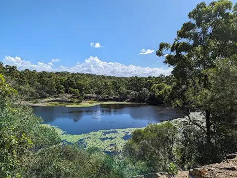 Daisy Hill Conservation Park Daisy Hill
Daisy Hill Conservation Park is a Queensland Parks bushland reserve off Daisy Hill Road, about 25 km south-east of Brisbane City via the M1, that protects koala habitat.
★ 4.7 (2,817)
-
 Karawatha Forest Discovery Centre Karawatha
Karawatha Forest Discovery Centre is a Brisbane City Council environment centre at 149 Acacia Road, Karawatha, at the edge of the 900-hectare Karawatha Forest.
★ 4.7 (1,420)
-
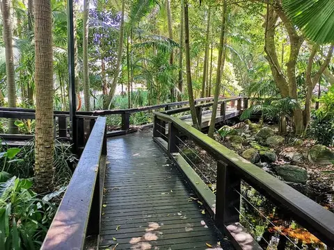 South Bank Rainforest Walk South Brisbane
The Rainforest Walk is a boardwalk through a patch of rainforest in the middle of the South Bank Parklands in South Brisbane.
★ 4.7 (71)
-
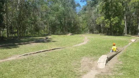 Gap Creek Reserve Mount Coot-tha
Gap Creek Reserve in Mount Coot-tha, Brisbane, is a nature reserve offering a short, shaded loop walk along a gentle creek lined with fig trees.
★ 4.7 (593)
-
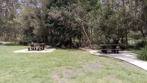 Bunyaville Conservation Park Albany Creek
Bunyaville Conservation Park is a Queensland Parks bushland reserve about 15 km north-west of central Brisbane, between Albany Creek and Everton Hills, with access via…
★ 4.6 (779)
-
 Downfall Creek Bushland Centre Chermside West
Brisbane City Council's family-friendly bushland centre in Raven Street Reserve, part of the Chermside Hills Reserves in Brisbane's north.
0.4 km · Wheelchair access · ★ 4.7 (382)
-
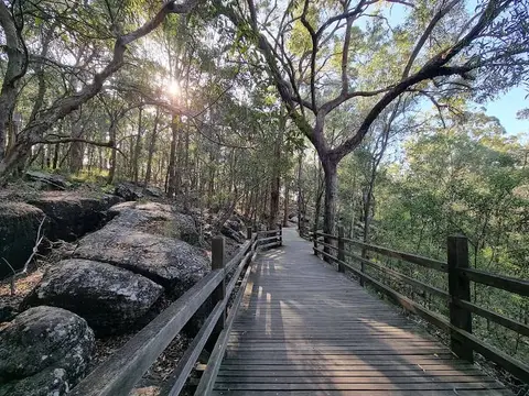 Toohey Forest Park Nathan
Toohey Forest Park is a Brisbane City Council bushland reserve of about 260 hectares at 600 Toohey Road, Nathan, 10 minutes from the CBD.
★ 4.6 (725)
-
 Nudgee Beach Reserve & Boardwalk Nudgee Beach
The Nudgee Beach Boardwalk is a 1.5-kilometre loop through the mangroves at Nudgee Beach, on the edge of Boondall Wetlands, Brisbane's largest wetlands.
★ 4.5 (813)
-
 Osprey House Environmental Centre Griffin
City of Moreton Bay's environment centre at Griffin, for discovering Moreton Bay's bird and marine life.
★ 4.7 (134)
-
 Fellowship Place Plane Spotting Area, Brisbane Airport Pinkenba
Fellowship Place is Brisbane Airport's plane spotting area on the Acacia Street Loop, opened in July 2026 for the airport's 100th year.
★ 4.4 (526)
-
 Simpsons Falls Track, Mt Coot-tha Reserve Mount Coot-tha
Simpsons Falls Track in Mt Coot-tha Reserve is 650 metres to Simpsons Falls, about 40 minutes.
0.65 km · moderate level of fitness · 40 minutes
-
 Banksia and Melaleuca Bicentennial bushwalks, Bribie Island Banksia Beach
Two linked easy bushwalks in Bribie Island National Park and Recreation Area, 65 km north of Brisbane.
1.5 km · Easy (walk) · Allow 1.25 hr walking time (Melaleuca); 15min (Banksia)
-
 Jollys Lookout and Egernia circuit (D'Aguilar National Park) Jollys Lookout
Jollys Lookout is a day-use area in D'Aguilar National Park about 28 km from Brisbane's city centre, with 180-degree views over the D'Aguilar Range to the Glass House…
1.5 km · Grade 3 walking track · Allow 1hr walking time
-
 Atrax circuit, D'Aguilar National Park Mount Glorious
Atrax circuit is a walk of 750m circuit in D'Aguilar National Park, Manorina (southern section), graded 'Grade 3 walking track', with a suggested time of 20 minutes.
0.75 km · Grade 3 walking track · 20 minutes
-
 Rainforest circuit, Maiala (D'Aguilar National Park) Mount Glorious
A 2 km circuit through subtropical rainforest that starts at Maiala day-use area on the edge of Mount Glorious, about 42 km from Brisbane's city centre.
2 km · Grade 3 walking track · Allow 1hr walking time
-
 Pitta circuit, D'Aguilar National Park Mount Nebo
Pitta circuit is a walk of 1km circuit in D'Aguilar National Park (southern section), graded 'Grade 3 walking track', with a suggested time of 30 minutes.
1 km · Grade 3 walking track · 30 minutes
-
 Tingalpa Creek circuit, Venman Bushland National Park Alexandra Hills
Venman Bushland National Park, about 40 km south of Brisbane city on West Mount Cotton Road, is one of the largest remaining areas of eucalypt forest in the coastal…
2.5 km · Grade 3 · Allow 1.5hr
-
 Sandgate Foreshore Sandgate
The Sandgate Foreshore is a 6.5-kilometre promenade along Flinders Parade, Sandgate, running from Shorncliffe to the Ted Smout Memorial Bridge.
-
 Boondall Wetlands Environment Centre Boondall
Brisbane City Council's environment centre in Boondall Wetlands, Brisbane's largest wetlands (about 1,150 hectares) on the edge of Moreton Bay.
2 km · easy · 1 hour (Billai dhagun Circuit) · Wheelchair access
All walks, waterfalls and lookouts in Brisbane, free and paid
Questions parents ask
- Are there waterfalls near Brisbane for kids?
- J.C. Slaughter Falls at Mt Coot-tha is a short bush walk away from the city. The flow depends on recent rain, so expect a trickle after a dry spell. The listing describes the walk.
- What is the best lookout for kids in Brisbane?
- Mt Coot-tha Lookout and Kangaroo Point Cliffs both give city views without a long walk. Keep children back from edges, and visit early or late to avoid the heat and the crowds.
- Is the Point Lookout Gorge Walk suitable for children?
- It suits school-age children who enjoy walking, with views and sometimes marine life. It involves a ferry trip, so plan the day around times, and check the listing for track conditions.
- How do we stay safe on bush walks in Brisbane?
- Wear closed shoes, carry plenty of water and keep to the track. Check the weather, leave early in summer, and take shelter from lightning. Teach children not to poke at logs and rocks.
Other kinds of free day in Brisbane
- All free things to do with kids in Brisbane
- Free beaches and rock pools
- Free water play and splash pads
- Free playgrounds worth the drive
- Free skate parks and bike tracks
- Chilled days: gardens, parklands and picnics
- Rain-safe: free museums, galleries and libraries
- Free things to do with toddlers
- Free things to do with teenagers